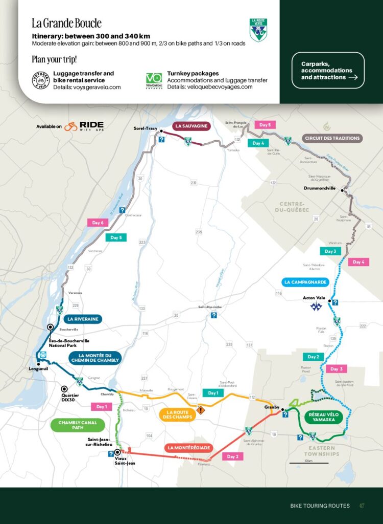
La Grande Boucle
Difficulty : Moderate
Type : 2/3bike path et 1/3 on-road
![]()
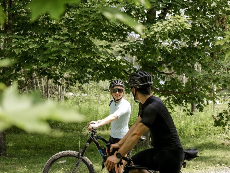
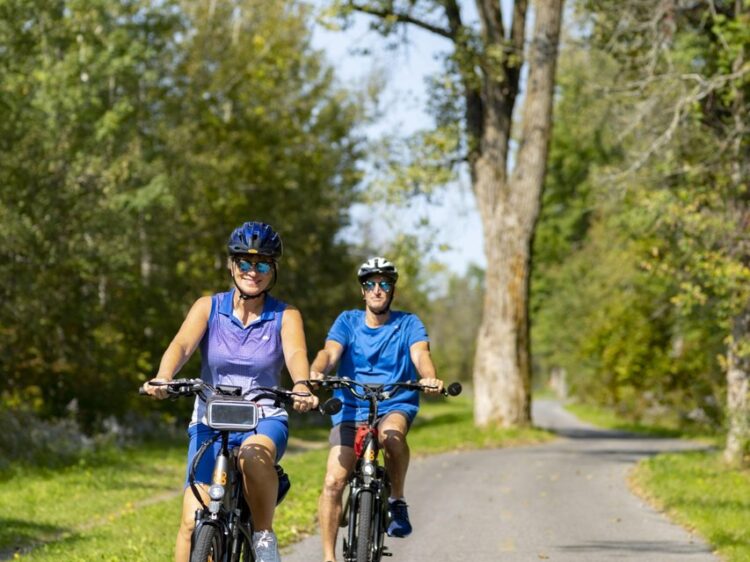
Tailored for adventure-loving cyclists, this touring route is doable in five to six days, depending on your riding pace. Luggage transfer services are available to simplify your trip. Be sure to map in your stops in advance since some places do not have signs along the road advertising their location.
Plan your trip!
 |
Forfaits clé en main Hébergement et transport de bagages |
 |
Service de transport de bagages et de location de vélo |
About the circuit
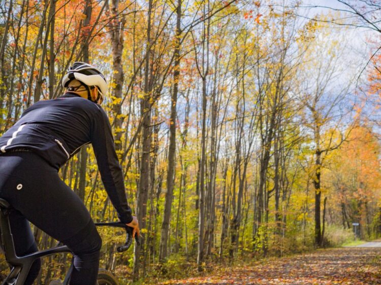
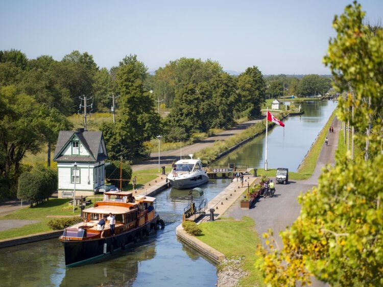
La Grande Boucle is a 340 km out-and-back consisting mostly of bike paths, with some on-road segments. It links together five of the Montérégie’s nicest rides, all of which are along La Route Verte. Over several days, you will travel across a natural quilt of countryside, quiet riverbanks and agritourism areas that speak to the region’s richness.
SUGGESTED ROUTE
Day 1 : Longueuil or Brossard to Saint-Jean-sur Richelieu (La Montée du chemin de Chambly – 28 km and Piste du Canal-de-Chambly – 20 km)
Day 2 : Saint-Jean-sur Richelieu to Granby (La Montérégiade – 48 km)
Day 3 : Granby to Acton Vale (La Campagnarde – 47 km)
Day 4 : Acton Vale to Drummondville (La Campagnarde – 20 km and Circuit des Traditions – 36 km)
Day 5 : Drummondville to Sorel-Tracy (Circuit des Traditions – 25 km and La Sauvagine – 12 km)
Day 6 : Sorel-Tracy to Longueuil or Brossard (La Riveraine – 80 km)
Îles-de-Boucherville National Park, Boucherville – Applicable access fees
From Grosbois Island, located in Îles-de-Boucherville National Park, you can take a river shuttle to Boucherville, where the Riveraine trail is located. Running along the river, this trail can take you either north to Sorel (shoulder of the Route Verte-Route 132) or south to the intersection of Route Verte axis 1. See information and schedules for the river shuttle.
Quartier DIX30, Brossard – Free
From the parking lot, the Quartier Dix30 bike path connects to the Route Verte trail safely and in just a few minutes.
Vieux Saint-Jean, Saint-Jean-sur-Richelieu – Free
Free parking lot P15 is located near the bike paths. See map
– Chambly
Restaurants
Bedondaine et Bedons Ronds brasseur artisan
Laboratoire culinaire Nord
FG Chocolatiers
Délires et délices
À visiter
Lieu historique national du Canal-de-Chambly
Lieu historique national du Fort-Chambly
La Galerie de Miss Rey
– Saint-Jean-sur-Richelieu
Restaurants
Buvette Laganière
Les Berges de Saint-Jean
Treize Chocolats
Hébergements
Holiday Inn
Gîte du Colibri – Mont-Saint-Grégoire
– À visiter – Farnham et environ
Halte Versailles – Mont-Saint-Grégoire
Saucisson Vaudois – Sainte-Brigide-d’Iberville
Fromagerie des Cantons – Farnham
Microbrasserie Farnham Ale & Lager – Farnham
Dimension Sport – Farnham
Parachute Montréal Rive-sud – Farnham
Place Publique Conrad-Blain – Farnham
Marché public de Farnham – Farnham
Halte Saint-Georges – Farnham
– Hébergements – Granby
Hôtel Castel
Magnolia B&B
Hôtel-Motel Granby
Parc national de la Yamaska (camping et chalet)
– Roxton Falls
Restaurants
Au Gîte des Oies
À visiter
Au Gîte des Oies
Les Trouvailles Gourmandes du Canton
Hébergements – Acton
Motel Valois
Domaine des îles enchantées
– Drummondville
Restaurants
Aubier Microbrasserie
Bibine Buvette
Le Baboune
Bistro de la Gare
Le Roy Jucep
À visiter
Axart
Parc Bellevue
Parc des Voltigeurs
Marché public Drummondville
Ferme des Voltigeurs
Hébergements
Comfort Inn Drummondville
Hôtel et Suites Le Dauphin
Camping des Voltigeurs
– Sorel-Tracy
Restaurants
Cabaret Les Années Folles
Restaurant Le Belvédère
À visiter
Maison du Marais
Statera – L’archipel fabuleux
Hébergements
Hôtel de la Rive
– Varennes et environ
Restaurants
Gaspard Brasserie Artisanale – Boucherville
À visiter
Vignoble Domaine du Fleuve
Sanctuaire Sainte-Marguerite-d’Youville
Église Sainte-Famille – Boucherville
Maison dite Louis-Hippolyte La Fontaine – Boucherville
Ride in complete freedom! The cycle network awaits you, free of obstacles and roadworks, for a fun-filled outing!
Services
-
Birdwatching
-
Drinking water
-
Free outdoor parking
-
Patrol
-
Picnic area
-
Rest stop with shelter
-
Route verte
-
Toilet
-
Waterfront view
-
Wildlife observation